 |
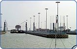
Navigation is a traditional activity on the Danube, facilitating the region’s economic development. The first tow path was built by the Roman emperor Trajan in 100 A.D. at the Iron Gate. Intensive works started in 1834 but the dangerous passage through the cataracts ceased with their impoundment over 270 km. In 1972, the Iron Gate I dam was completed and Iron Gate II dam was added in 1984. In the delta, the Sulina arm was made navigable for large sea ships between 1857 and 1902, shortening its formerly meandering route from 85 km to 62 km. The Danube countries have co-operated in navigation since 1856. In 1948, the Danube Commission was founded in Belgrade. In an annex to the 1988 Danube Convention on Navigation, a further moderate expansion of the navigation route was recommended for the waterway between Regensburg and the delta. All Danube dams between Regensburg and the Iron Gate serve navigation needs. The tributaries also used for navigation include the Drava (up to Cadrice at rkm 1015), the Tisza (up to Dombrad at rkm 600), the Sava up to Sisak at rkm 583 and a short section of the Prut. Three artificial waterways have been built on the Danube:
While navigation is widely perceived as a cheap, environment-friendly means of transportation, it must be recognised that it contributes to waterwater pollution through accidental and illegal release of toxic substances (bilge oil, wash waters). |
 |
|
|||
 |
NAVIGATION |
|||
|
||||
|
|
||||
 |
